Loading subject page…


2,229 views

Video Summary: What Is Latitudes and Departures
Ever wondered how GPS systems calculate your exact location with pinpoint accuracy? Area computation by the alternative method relies on understanding latitudes and departures, the fundamental building blocks of surveying that enable precise land measurement. These mathematical projections help surveyors map everything from residential subdivisions in Texas to national park boundaries in Colorado. What is latitudes and departures becomes crucial when surveyors need to close traverses and eliminate measurement errors for accurate property boundaries. Watch the full video on JoVE Coach to master this concept with expert-led visuals and step-by-step explanations.
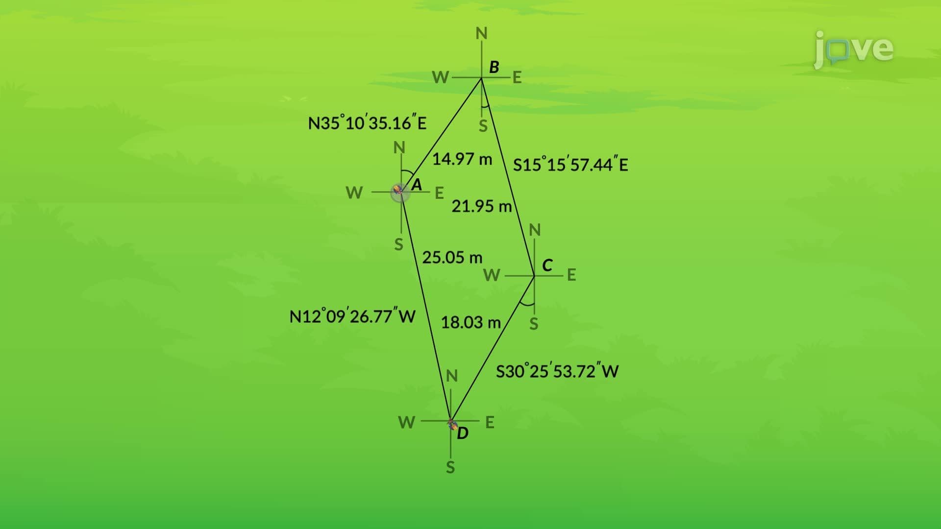
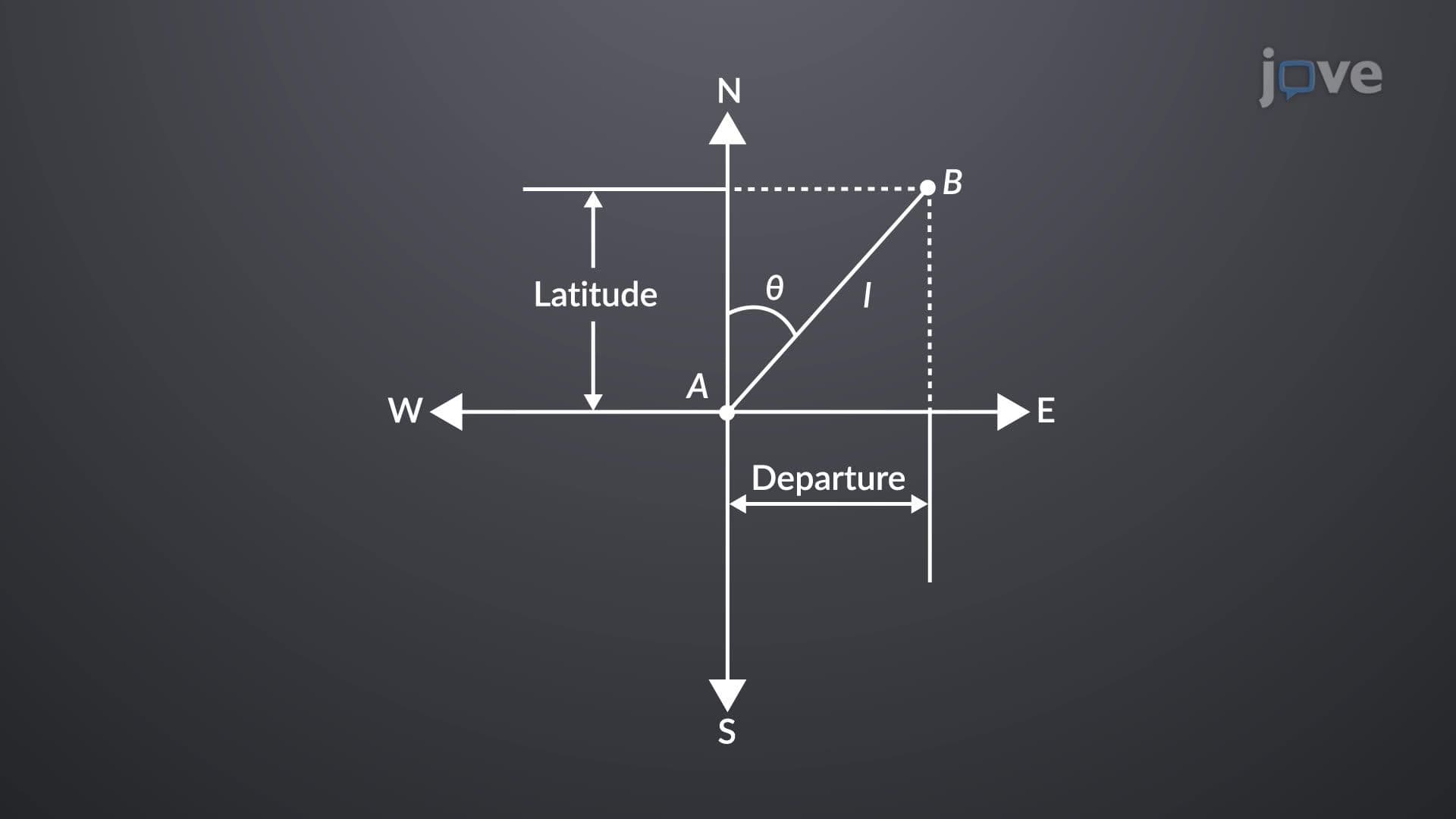
Latitudes and departures form the mathematical foundation of modern surveying, transforming angular measurements and distances into rectangular coordinate systems. A latitude represents the north-south component of any survey line, calculated by multiplying the line's measured length by the cosine of its bearing angle. Conversely, a departure captures the east-west component, determined by multiplying the same length by the sine of the bearing angle. These calculations essentially break down diagonal survey lines into perpendicular components that align with our familiar x-y coordinate system.
The sign convention for latitudes and departures follows intuitive geographic principles. Latitudes carry positive values for northerly directions and negative values for southerly directions. Similarly, departures are positive when pointing east and negative when pointing west. This systematic approach allows surveyors to maintain consistency across large projects, whether mapping a suburban development in Arizona or establishing boundary lines for agricultural land in Iowa.
Professional surveying demands mathematical precision, particularly in closed traverses where survey lines form complete polygons. The fundamental principle requires that algebraic sums of all latitudes equal zero, and algebraic sums of all departures also equal zero. When these sums deviate from zero, surveyors identify measurement errors that must be systematically corrected. This closure requirement serves as a built-in quality control mechanism, essential for legal property descriptions and engineering projects.
The compass rule provides the standard method for distributing unavoidable measurement errors across traverse sides. This technique proportionally adjusts each line's latitude and departure based on the line's length relative to the total traverse perimeter. Longer lines receive proportionally larger adjustments, reflecting the statistical reality that longer measurements typically contain greater absolute errors. This systematic approach ensures that final coordinates maintain the highest possible accuracy for area computation and boundary determination.
Students preparing for AP Physics, college-level surveying courses, or engineering programs will encounter these concepts in coordinate geometry, trigonometry applications, and practical measurement scenarios. Understanding latitudes and departures proves essential for careers in civil engineering, land surveying, geographic information systems, and urban planning.
Related Micro-courses