21 Concepts
14 Concepts
11 Concepts
11 Concepts
16 Concepts
8 Concepts
18 Concepts
12 Concepts
6 Concepts
12 Concepts
6 Concepts
5 Concepts
6 Concepts
9 Concepts
8 Concepts
8 Concepts
7 Concepts
9 Concepts
10 Concepts
8 Concepts
13 Concepts
5 Concepts
11 Concepts
10 Concepts
7 Concepts
6 Concepts
9 Concepts
10 Concepts
6 Concepts
9 Concepts

Traverse surveying forms the foundation of modern land measurement and mapping across the United States. This comprehensive course covers traverse survey methods including angle adjustment, latitude and departure calculations, and area computations for boundary determination. Students explore topographic survey methods using total stations and GPS technology, learning to create accurate contour maps essential for construction projects from Florida's coastal developments to Colorado's mountain engineering. Master these fundamental surveying techniques with JoVE Coach.
1. Traverse Adjustment and Error Correction: Understanding how measurement errors accumulate in traverse surveying and learning systematic correction methods. When surveying a four-sided property boundary in Texas, if internal angles sum to 359°48' instead of the required 360°, the 12-minute error must be distributed equally among all angles (3 minutes each) to achieve geometric closure. This fundamental principle ensures accurate property boundaries for legal documentation and construction planning throughout the United States.
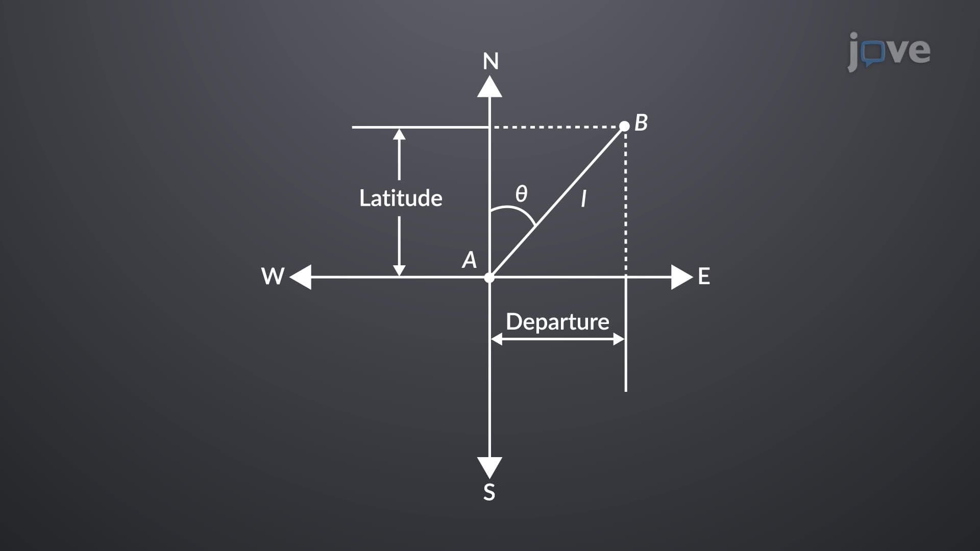
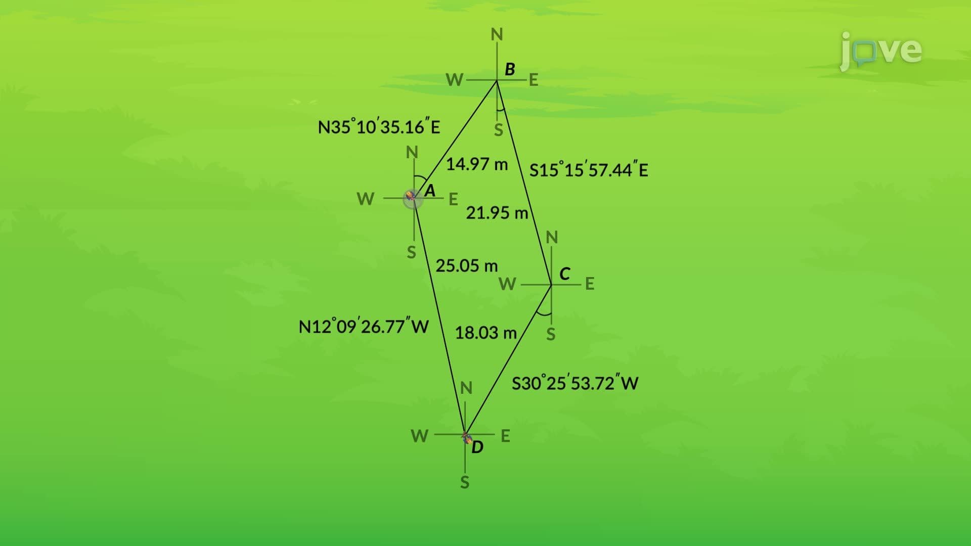
2. Latitude and Departure Calculations: Mastering the mathematical foundation of traverse analysis through coordinate projections. Latitudes represent north-south components (length × cosine of bearing), while departures represent east-west components (length × sine of bearing). For a closed traverse around a Colorado mountain property, the algebraic sum of all latitudes and departures must equal zero. Positive values indicate northerly/easterly directions, while negative values represent southerly/westerly directions, enabling precise coordinate determination.
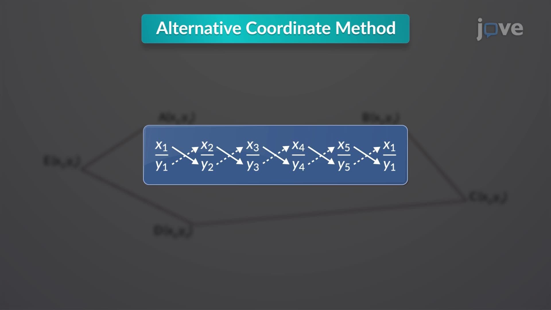
3. Area Computation Using Coordinate Methods: Learning the alternative coordinate method for calculating enclosed areas within traverse boundaries. This technique involves arranging corner coordinates sequentially, creating diagonal multiplication patterns, and applying the formula: Area = |Σ(xi × yi+1) - Σ(yi × xi+1)|/2. When determining the area of a development site in Arizona, this method provides accurate results for land valuation, zoning compliance, and construction planning, making it essential for surveying professionals.
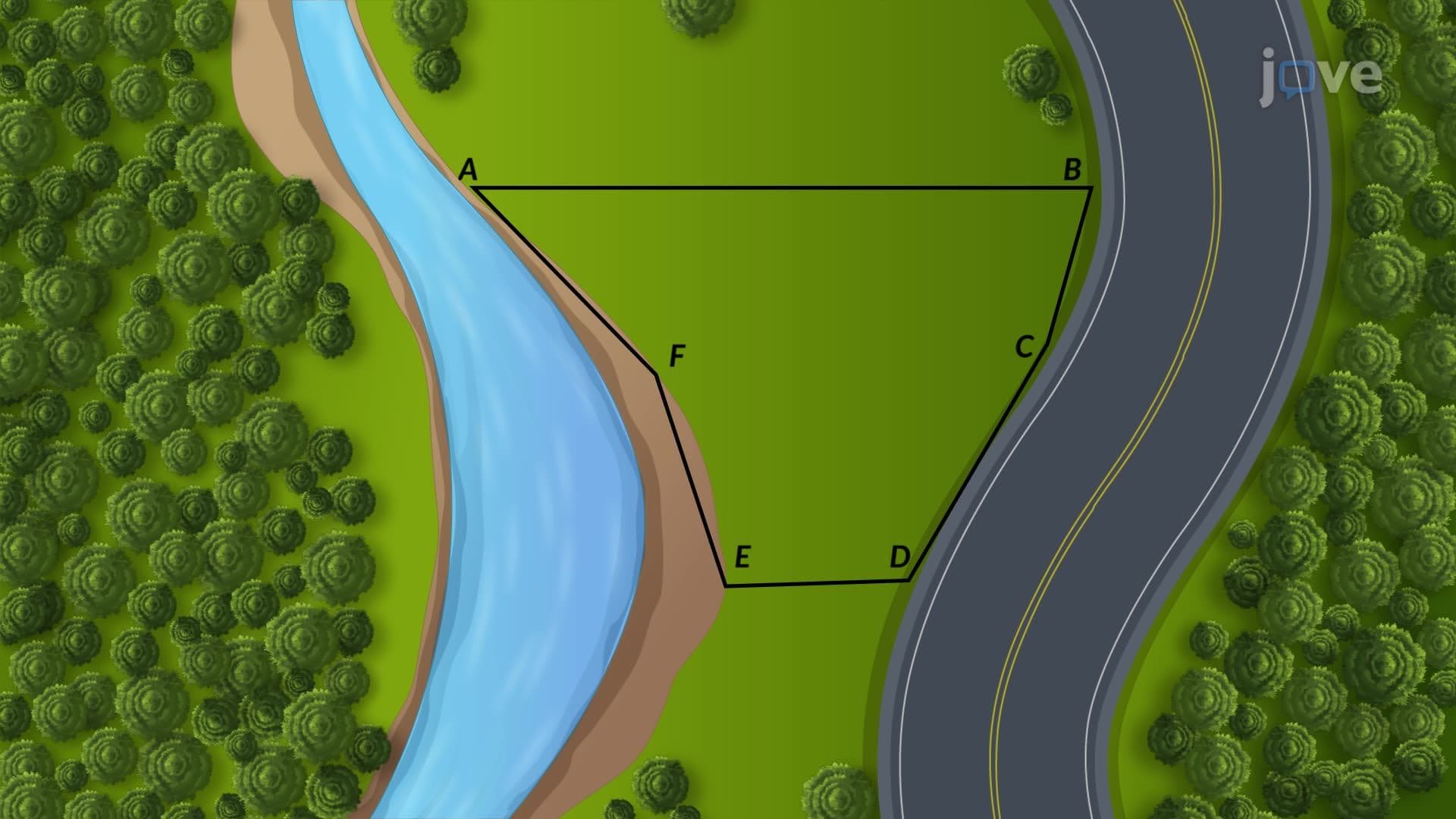
4. Irregular Boundary Area Measurement: Exploring specialized techniques for measuring areas bounded by natural features like rivers or curved roadways. The planimeter provides 99% accuracy when tracing irregular boundaries on scaled drawings, while numerical methods like the trapezoidal rule and Simpson's one-third rule offer computational alternatives. These methods prove essential when surveying waterfront properties along California's coastline or calculating wetland areas for environmental impact assessments.
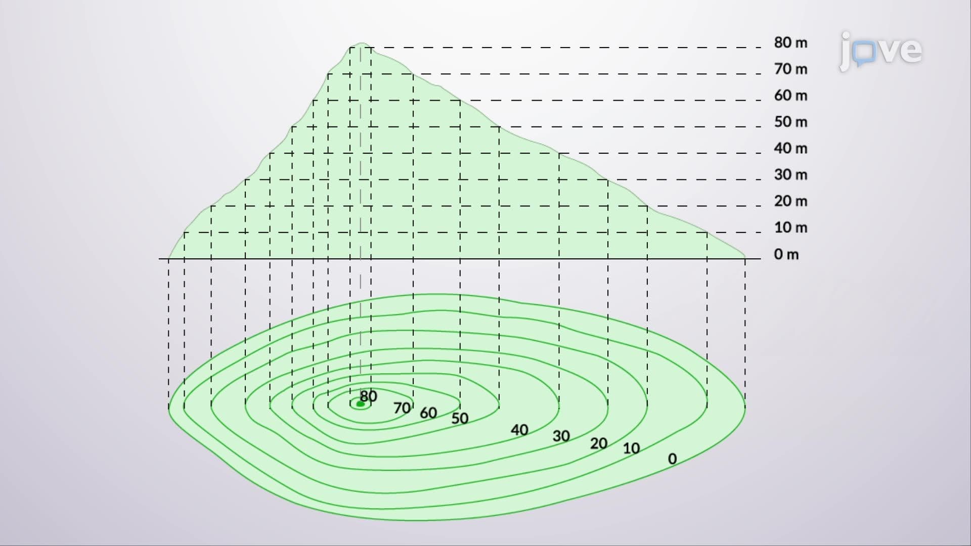
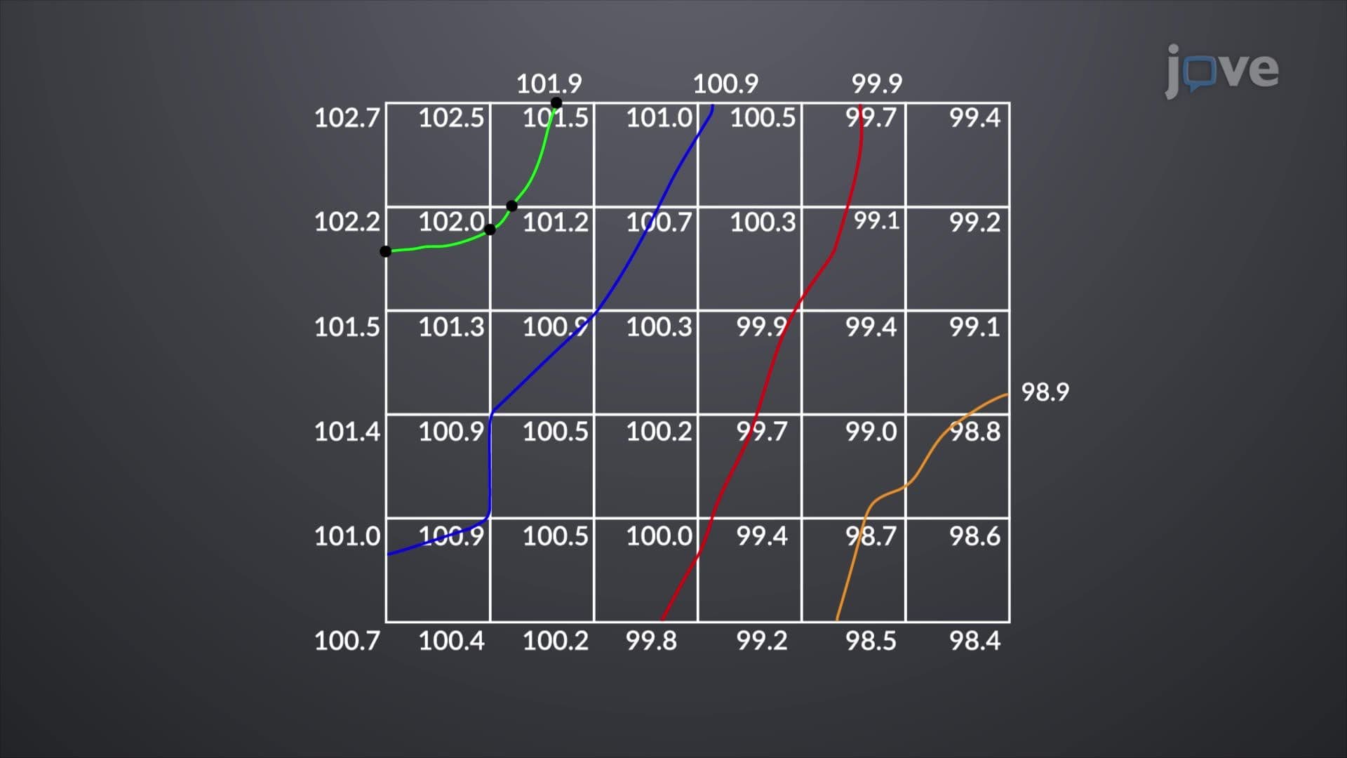
5. Topographic Surveying and Contour Mapping: Understanding elevation measurement and terrain representation through contour lines connecting points of equal elevation. Closely spaced contours indicate steep terrain (common in Appalachian surveys), while widely spaced contours represent gentle slopes (typical in Midwest agricultural surveys). Modern total stations and GPS equipment collect elevation data efficiently, enabling surveyors to create detailed topographic maps for construction projects, flood studies, and land development across diverse American landscapes.
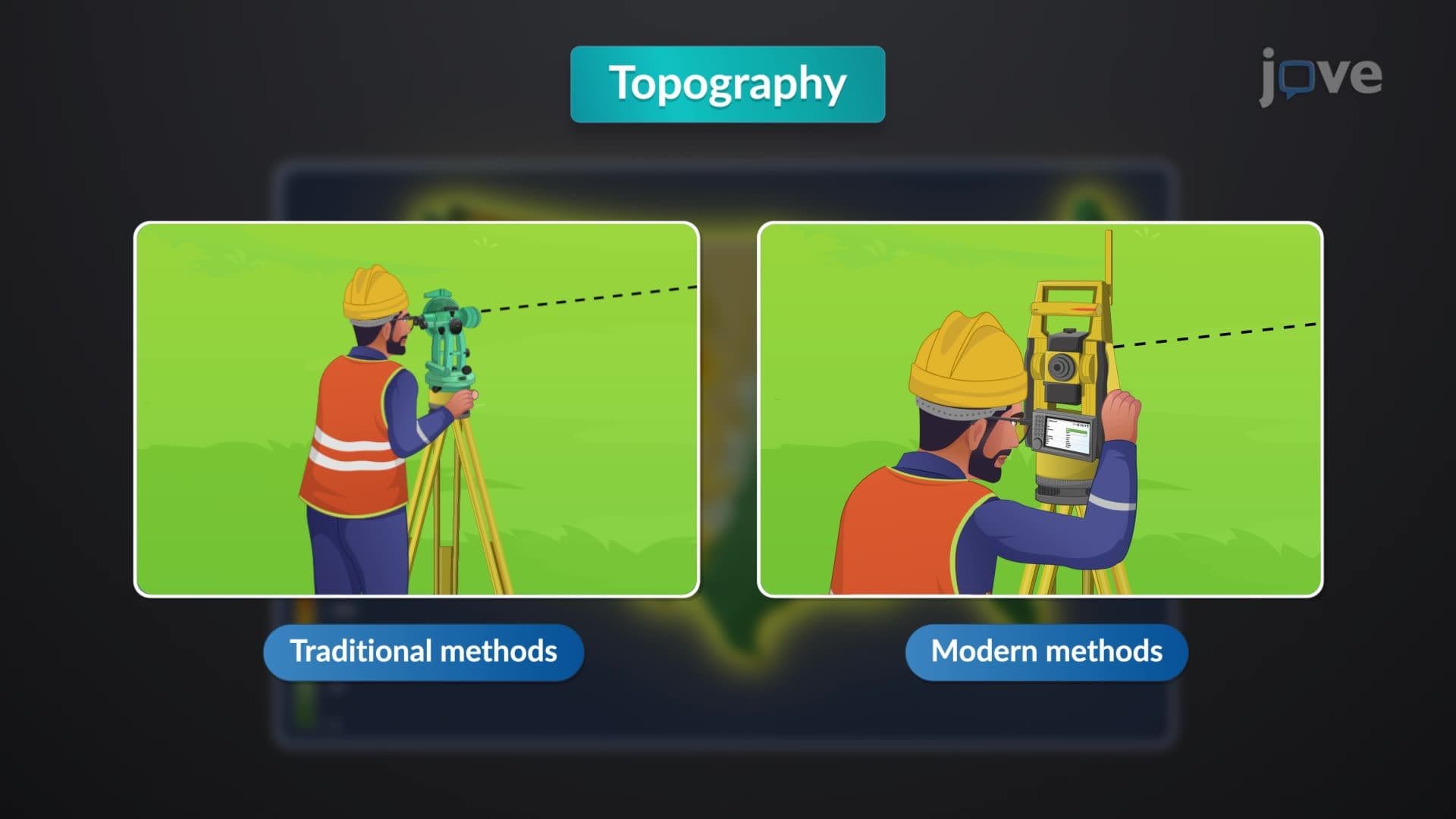
6. Modern Survey Technology and Methods: Comparing traditional transit-stadia methods with contemporary total station and GPS technology for topographic data collection. Total stations measure angles and distances electronically, recording up to 1,000 points daily while calculating coordinates automatically. GPS provides rapid, accurate positioning for large-scale mapping projects. These technologies revolutionize surveying efficiency from urban developments in New York to rural infrastructure projects in Montana, reducing survey time and increasing accuracy for engineering applications.