Loading subject page…

- Civil Engineering
- Angles and Directions
- Azimuths and Bearings
Micro-course: Angles and Directions
2,776 views
Learn key concepts and earn your certificate.


Azimuths and Bearings

00:00
01:19
Video Summary: What Is Azimuths and Bearings
Ever wondered how GPS navigation systems know exactly which direction to guide you? The compass plays a crucial role in directional measurements through two fundamental systems: azimuths and bearings. Surveying projects across the United States, from mapping Central Park in New York to planning highway routes in Texas, rely on these compass-based directional systems to establish precise angular measurements from reference points. Understanding What is Azimuths And Bearings reveals how professionals translate compass readings into standardized directional data for engineering and navigation applications. Watch the full video on JoVE Coach to master this concept with expert-led visuals and step-by-step explanations.
- Understand What is Azimuths And Bearings and distinguish between these two compass-based directional measurement systems used in surveying and navigation
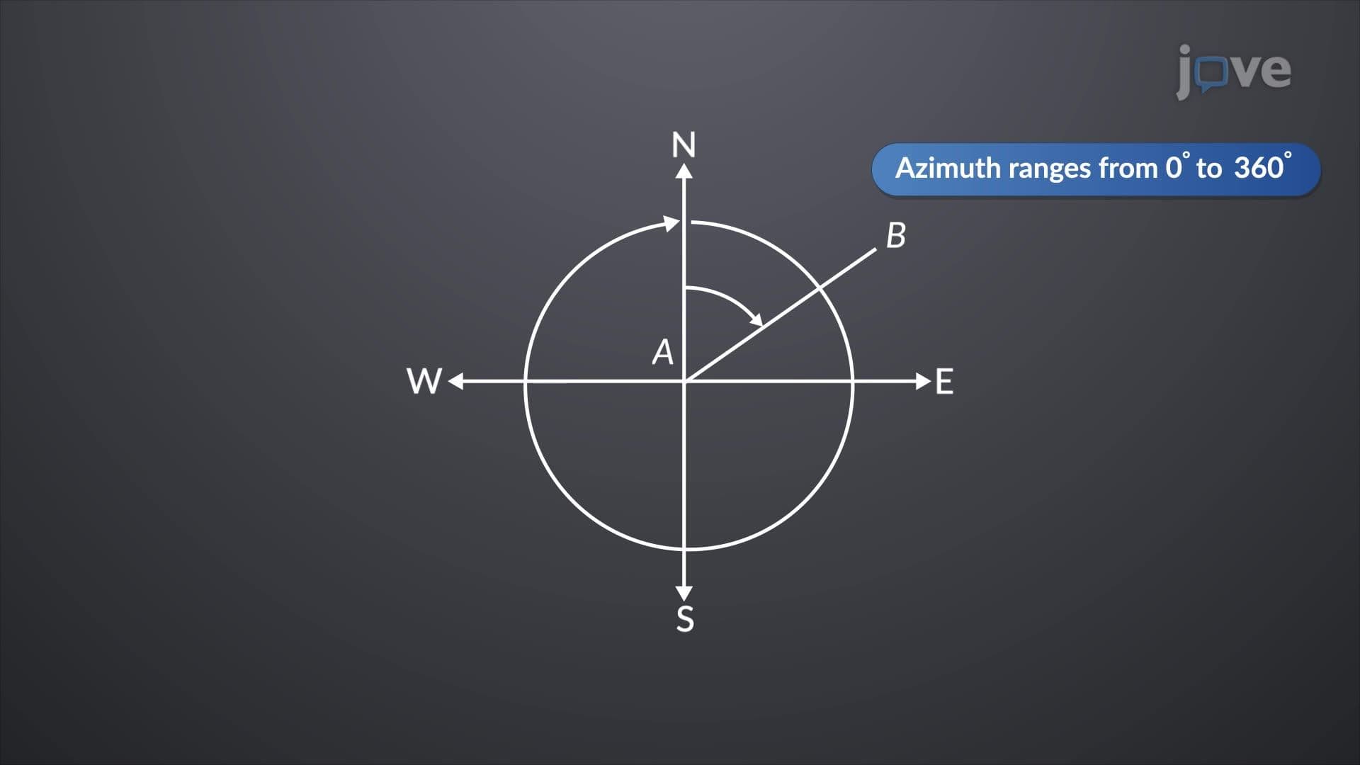
- Identify how azimuth measurements range from 0° to 360° clockwise from north, while bearing measurements use quadrant-based references with maximum 90° angles
- Analyze the mathematical relationship between forward and back azimuths by adding or subtracting 180° to determine reverse directional measurements
- Compare azimuth notation (single angle) versus bearing notation (reference direction + angle + inclination direction) for expressing the same directional line
- Evaluate how compass readings translate into practical surveying measurements for real-world engineering and construction projects
- Apply conversion techniques between azimuth and bearing systems when working with different surveying equipment and documentation standards
- Recognize how quadrant changes affect azimuth calculations differently than bearing calculations in compass-based measurements
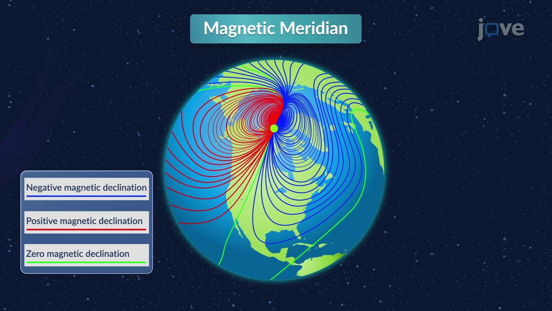
- Explore the fundamental role of meridian reference lines in establishing consistent directional measurements across geographic surveys
Understanding What is Azimuths And Bearings: Compass Fundamentals
The compass serves as the foundation for two essential directional measurement systems in surveying and engineering: azimuths and bearings. These systems provide standardized methods for expressing direction using compass principles, enabling precise communication of angular measurements across professional applications. While both systems describe the same directional information, they use different notation conventions that serve specific purposes in various fields.
Azimuth System: 360-Degree Compass Measurements
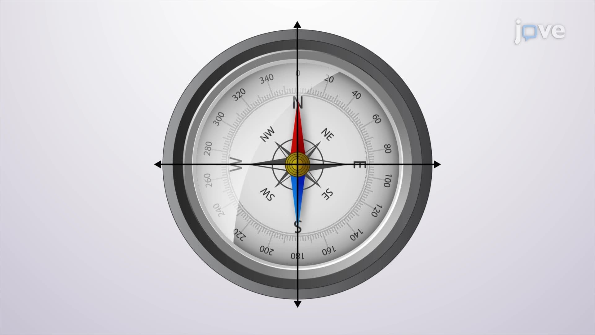
Azimuth represents the most straightforward compass-based directional system, measuring clockwise angles from the north meridian. This compass definition encompasses measurements ranging from 0° (due north) to 360° (returning to north). The system's simplicity makes it particularly valuable for GPS navigation, military applications, and modern surveying equipment.
When working with azimuth measurements, professionals can easily determine reverse directions by applying the 180-degree rule. For instance, if a survey line from point A to point B shows an azimuth of 125°, the back azimuth (from B to A) equals 305° (125° + 180°). This mathematical relationship remains constant regardless of the line's position, making azimuth calculations predictable and reliable for compass-based work.
Bearing System: Quadrant-Based Compass References
The bearing system offers a more intuitive compass overview by dividing directional measurements into four quadrants, each referenced from either north or south. This approach limits angles to 90° maximum, expressing direction through three components: reference meridian (North or South), angular measurement, and deviation direction (East or West).
Understanding compass in detail through the bearing system reveals why many surveyors prefer this notation for field work. A bearing of "North 35° East" immediately communicates both the general direction (northeastern quadrant) and precise angular measurement. This compass concept proves especially valuable when describing property boundaries or navigation routes where intuitive directional understanding matters.
Practical Applications in US Surveying and Engineering
Both azimuth and bearing systems find extensive use across American surveying projects. The California State Plane Coordinate System utilizes azimuth measurements for large-scale mapping projects, while property surveys in states like Florida often employ bearing notation for boundary descriptions in legal documents.
Engineering students preparing for Fundamentals of Engineering (FE) exam questions frequently encounter compass basics through surveying problems requiring conversions between these systems. Similarly, AP Environmental Science students studying watershed mapping must understand how compass study guide principles apply to topographic analysis and environmental monitoring projects.
Professional surveyors working on infrastructure projects, such as the Interstate Highway System expansions, rely on both systems depending on equipment specifications and client requirements. Modern GPS units typically display azimuth readings, while traditional surveying instruments may use bearing notation, requiring professionals to master both compass-based measurement approaches.
Frequently Asked Questions
Azimuths and bearings are two different systems for expressing direction using compass measurements. Azimuth measures clockwise angles from north (0°-360°), while bearing uses quadrant references with maximum 90° angles from north or south. Both systems describe the same directional information but use different notation methods preferred in various surveying and navigation applications.
AP Environmental Science exams often include compass-based problems in watershed analysis, habitat mapping, and pollution source tracking questions. Students typically encounter scenarios requiring directional measurements between monitoring stations or calculating stream flow directions. These problems test understanding of how compass readings translate into environmental data collection and spatial analysis skills.
The FE exam includes surveying problems requiring azimuth-to-bearing conversions, back-azimuth calculations, and directional measurement applications. Test-takers encounter questions involving property boundary surveys, construction site layout, and coordinate system transformations. Strong compass fundamentals help solve these problems efficiently within the exam's time constraints.
Professional surveyors use compass-based directional systems to establish precise property boundaries for legal documentation and construction planning. For example, surveying a residential subdivision in Colorado might involve bearing measurements like "South 45° West for 150 feet" to describe lot boundaries. These measurements become legally binding descriptions in property deeds and municipal planning documents.
Basic compass concepts require only fundamental arithmetic and angle measurement understanding taught in high school geometry. The primary mathematical operations involve addition and subtraction of angles, plus understanding of coordinate systems. Most students with Algebra I background can successfully learn azimuth and bearing calculations through practice and application.
Create practice problems using real-world scenarios, such as navigation between US cities or surveying local landmarks. Draw compass diagrams showing quadrants and practice converting between azimuth and bearing notation. Use online compass simulators to visualize angle relationships, and work through previous exam questions from your specific test (AP, FE, or college course) to understand question formats.
Professional roles requiring compass expertise include civil engineering, surveying, environmental consulting, forestry, mining engineering, and military service. Additionally, careers in GPS technology development, geographic information systems (GIS), urban planning, and construction management benefit from solid compass measurement knowledge for spatial analysis and project coordination tasks.
Advanced compass applications include coordinate system transformations, magnetic declination corrections, and three-dimensional directional measurements. Students can explore topics like spherical trigonometry for global navigation, GIS coordinate systems, and photogrammetry applications. These subjects build upon basic azimuth and bearing knowledge for specialized engineering and geospatial careers.
Related Micro-courses

9 Concepts

10 Concepts

6 Concepts