Loading subject page…

Micro-course: Angles and Directions
2,775 views
Learn key concepts and earn your certificate.

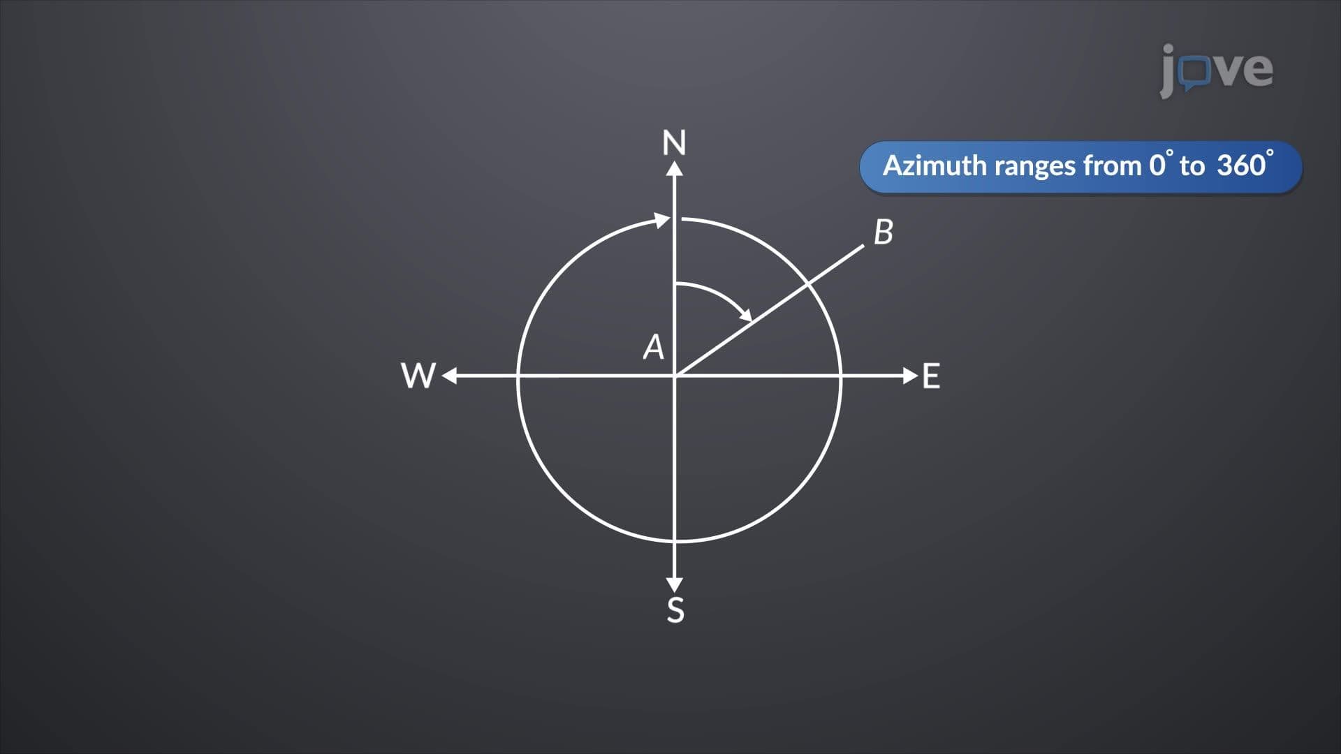

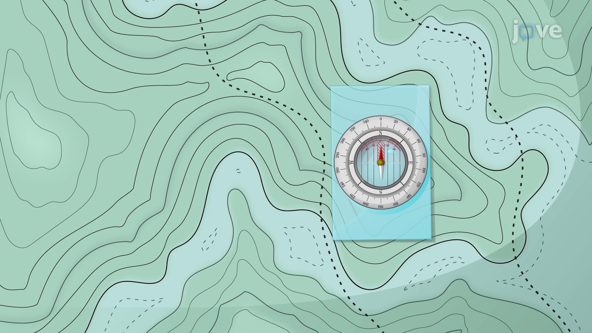

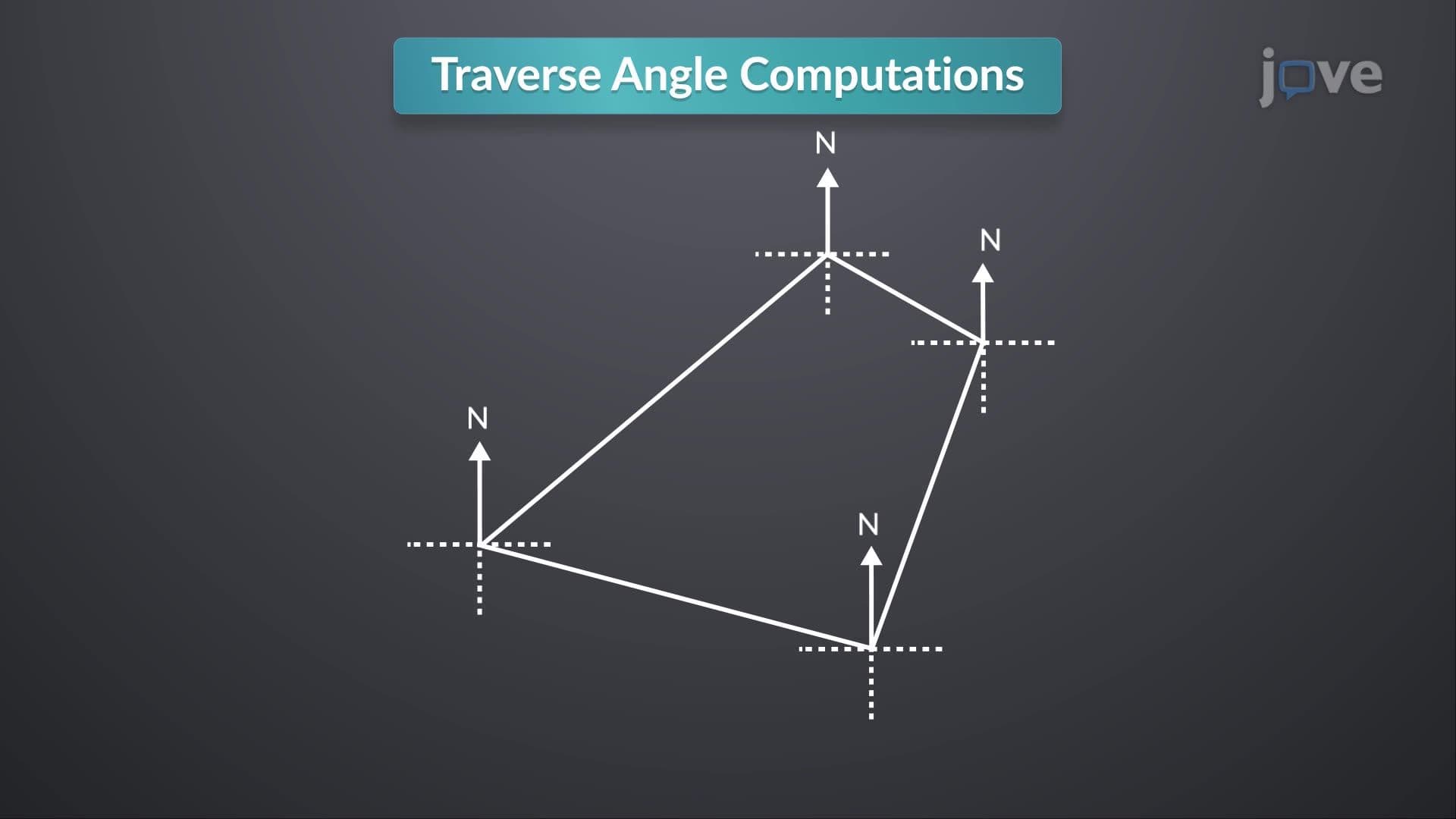
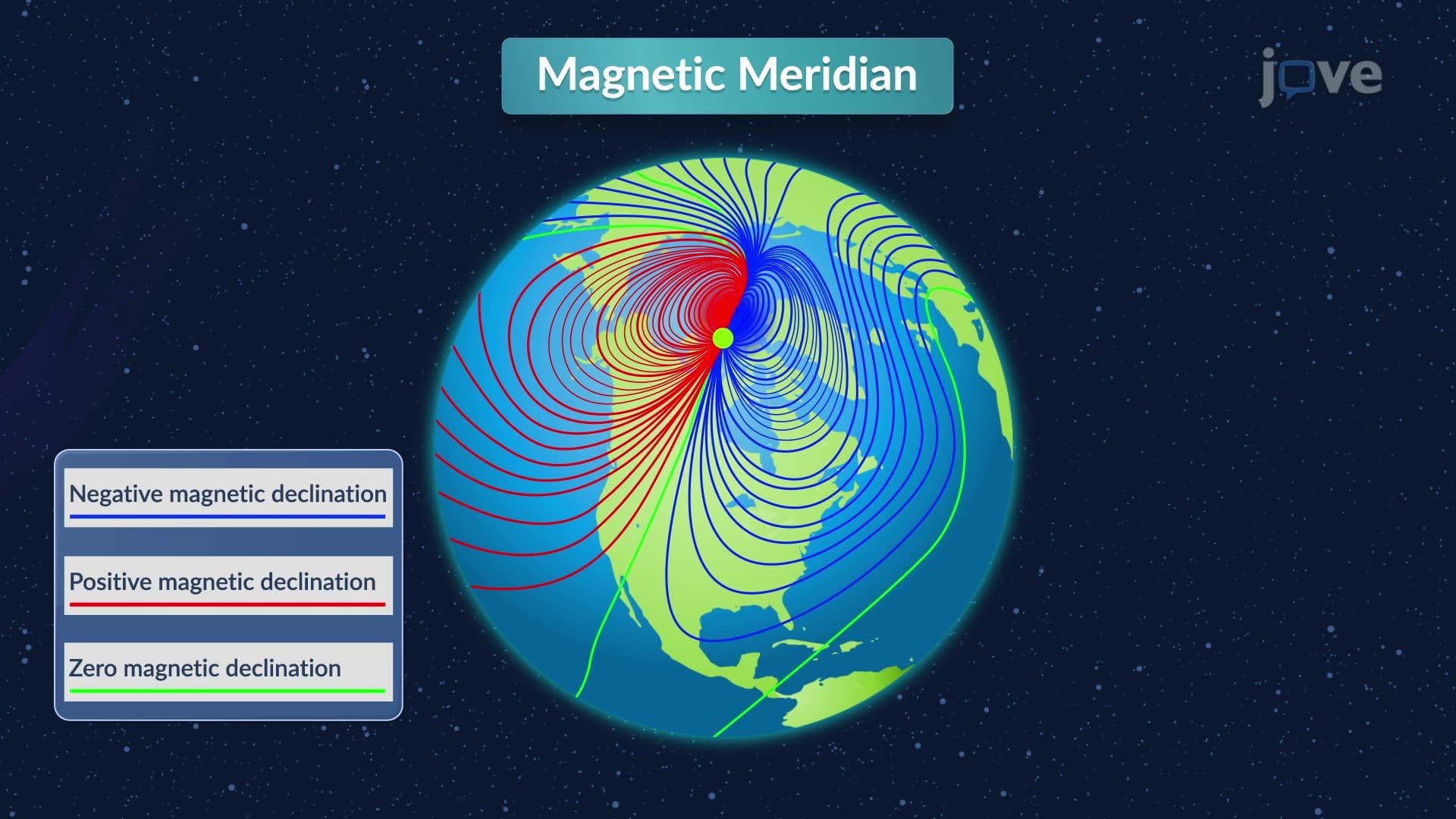
Meridians

00:00
01:28
Video Summary: What Is Meridians
Ever wonder how GPS systems know exactly where you are, or how surveyors mapped the entire continental United States with pinpoint accuracy? The secret lies in understanding azimuths and bearings, which rely on meridians as fundamental reference lines. Meridians are fixed north-south lines that surveyors use to measure precise directions, from mapping the California coastline to establishing property boundaries in Texas subdivisions. These reference systems include astronomic, magnetic, assumed, and grid meridians, each serving specific surveying needs. Watch the full video on JoVE Coach to master this concept with expert-led visuals and step-by-step explanations.
- Understand what meridians are and how they serve as foundational reference lines for measuring directions in surveying applications
- Identify the four main types of meridians: astronomic, magnetic, assumed, and grid meridians used in professional surveying
- Compare the advantages and limitations of each meridian type, including their accuracy and practical applications
- Analyze how astronomic meridians use stellar observations like Polaris to maintain long-term directional consistency
- Evaluate when magnetic meridians are appropriate despite their variability due to Earth's changing magnetic field
- Apply knowledge of assumed meridians for simplified local surveys and understand their reestablishment challenges
- Recognize how grid meridians reduce complexity in regional surveying projects through parallel reference systems
- Explore the relationship between meridians and directional measurement systems used in modern surveying practice
Understanding Meridians in Modern Surveying
Meridians form the backbone of directional measurement in surveying, serving as the primary reference system for azimuths and bearings. These north-south reference lines enable surveyors to establish precise directional measurements essential for everything from residential property boundaries to massive infrastructure projects like the Interstate Highway System. Understanding the azimuths and bearings definition requires grasping how meridians provide the fixed reference framework that makes accurate directional measurement possible.
Types of Meridians and Their Applications
Astronomic meridians represent the gold standard for long-term surveying accuracy. By aligning with true astronomical north through observations of Polaris (the North Star), these meridians maintain consistent direction regardless of location or time. The U.S. Public Land Survey System, which mapped much of the western United States, relied heavily on astronomic meridians. This system enabled surveyors to establish the precise grid of townships and sections still used today for property descriptions from Ohio to California.
Magnetic meridians, while less precise, offer practical advantages for field work. These meridians align with compass needle orientation, making them accessible for quick directional references. However, magnetic declination-the difference between magnetic north and true north-varies significantly across the United States. For example, in Maine, magnetic declination is approximately 16 degrees west, while in Washington State, it's about 15 degrees east. This variation limits magnetic meridians' usefulness for precise work.
Assumed meridians provide flexibility for localized projects where absolute directional accuracy isn't critical. Surveyors might establish an assumed meridian by designating the direction between two prominent landmarks as "north." This approach works well for subdivision layouts or construction surveys but creates challenges if reference points are lost.
Practical Applications and Exam Relevance
For students preparing for the Fundamentals of Surveying (FS) exam or college-level surveying courses, understanding what is azimuths and bearings in detail means recognizing how meridians establish the reference framework. AP Environmental Science students encounter meridians when studying GPS technology and land management systems. The concept appears frequently in civil engineering programs, particularly in courses covering boundary surveying and construction layout.
Grid meridians represent modern surveying's evolution, creating networks of parallel reference lines based on mathematical projections. The State Plane Coordinate System, used throughout the United States, employs grid meridians to minimize distortion across individual states. This system enables surveyors in Texas to work with different grid zones, each optimized for that region's geography while maintaining connection to the broader national coordinate framework.
Frequently Asked Questions
Meridians are fixed north-south reference lines that provide the fundamental framework for measuring directions in surveying. They enable surveyors to establish precise azimuths and bearings, ensuring consistent directional measurements across projects. Without meridians, accurate property boundaries, construction layouts, and mapping would be impossible.
AP Environmental Science tests often include questions about GPS technology and land management systems that rely on meridian-based directional measurements. Understanding how astronomic meridians provide reference for satellite positioning systems helps students analyze human impact on landscapes. These concepts also appear in questions about agricultural land division and urban planning.
Astronomic meridians align with true north using stellar observations, maintaining consistent direction over time, making them ideal for precise surveys like the U.S. Public Land Survey System. Magnetic meridians follow compass needle direction, which varies by location and changes over time due to magnetic declination. College courses emphasize astronomic meridians for boundary surveys while teaching magnetic meridians for reconnaissance work.
Highway construction projects use grid meridians from the State Plane Coordinate System to maintain directional consistency across long distances. For example, when building Interstate 10 across Texas, engineers used multiple grid zones, each with its own meridian network, to minimize measurement distortion while ensuring seamless connection between project segments.
Basic trigonometry and coordinate geometry are sufficient for understanding meridians and their applications. High school algebra and geometry provide adequate foundation for learning azimuths and bearings basics. The concepts focus more on spatial visualization and practical application than complex calculations.
Focus on understanding when to use each meridian type rather than memorizing definitions. Practice identifying appropriate meridian choices for different scenarios: astronomic for boundary surveys, magnetic for reconnaissance, assumed for local projects. Create comparison charts showing advantages and limitations of each type.
After understanding meridians, explore coordinate systems, particularly State Plane and UTM systems used throughout the United States. Study horizontal and vertical datums, GPS principles, and modern electronic distance measurement. These topics build directly on meridian concepts while preparing you for advanced surveying applications.
GPS technology still relies on meridian principles but uses mathematically defined reference systems instead of physical observations. The World Geodetic System (WGS84) used by GPS creates a global meridian network that provides the reference framework for satellite positioning. Understanding traditional meridians helps students grasp how GPS maintains directional accuracy worldwide.
Related Micro-courses

9 Concepts

10 Concepts

6 Concepts