Loading video…


 7 Concepts
 2.8K views

Video Summary: Design Example Maintaining Level of Explained
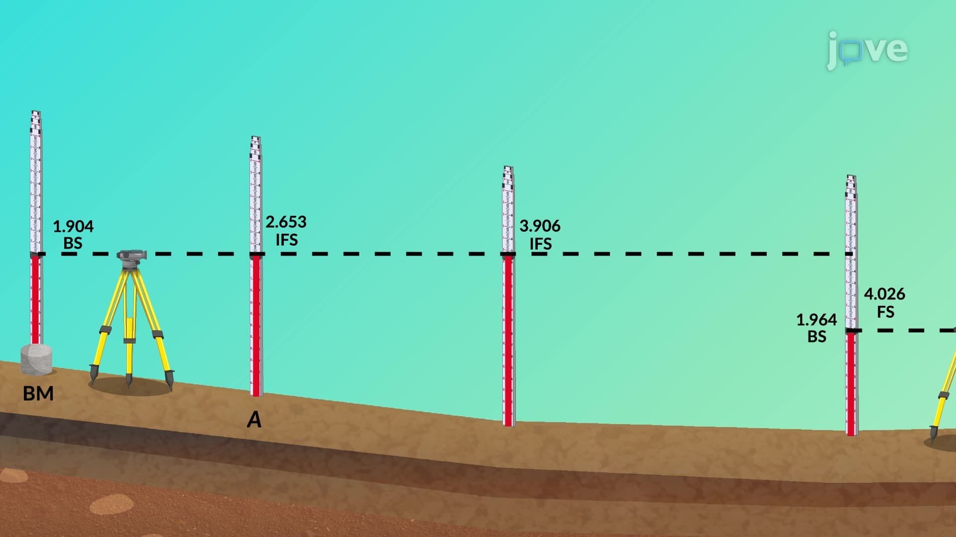
Meridians serve as invisible reference lines that help surveyors and engineers create precise elevation maps for major infrastructure projects like California's High-Speed Rail system. Understanding meridians definition becomes crucial when establishing accurate horizontal and vertical control points for large-scale construction projects. The design example maintaining level of explained demonstrates how surveyors use meridian-based coordinate systems alongside leveling instruments to ensure roadway embankments maintain proper gradual slopes across uneven terrain. Watch the full video on JoVE Coach to master this concept with expert-led visuals and step-by-step explanations.
Meridians form the backbone of precise surveying and engineering design across the United States. These imaginary north-south lines create a standardized coordinate system that allows engineers to maintain consistent reference points across vast construction projects. When combined with elevation control methods, meridians enable the accurate positioning required for infrastructure projects like the Interstate Highway System or major airport runway construction.
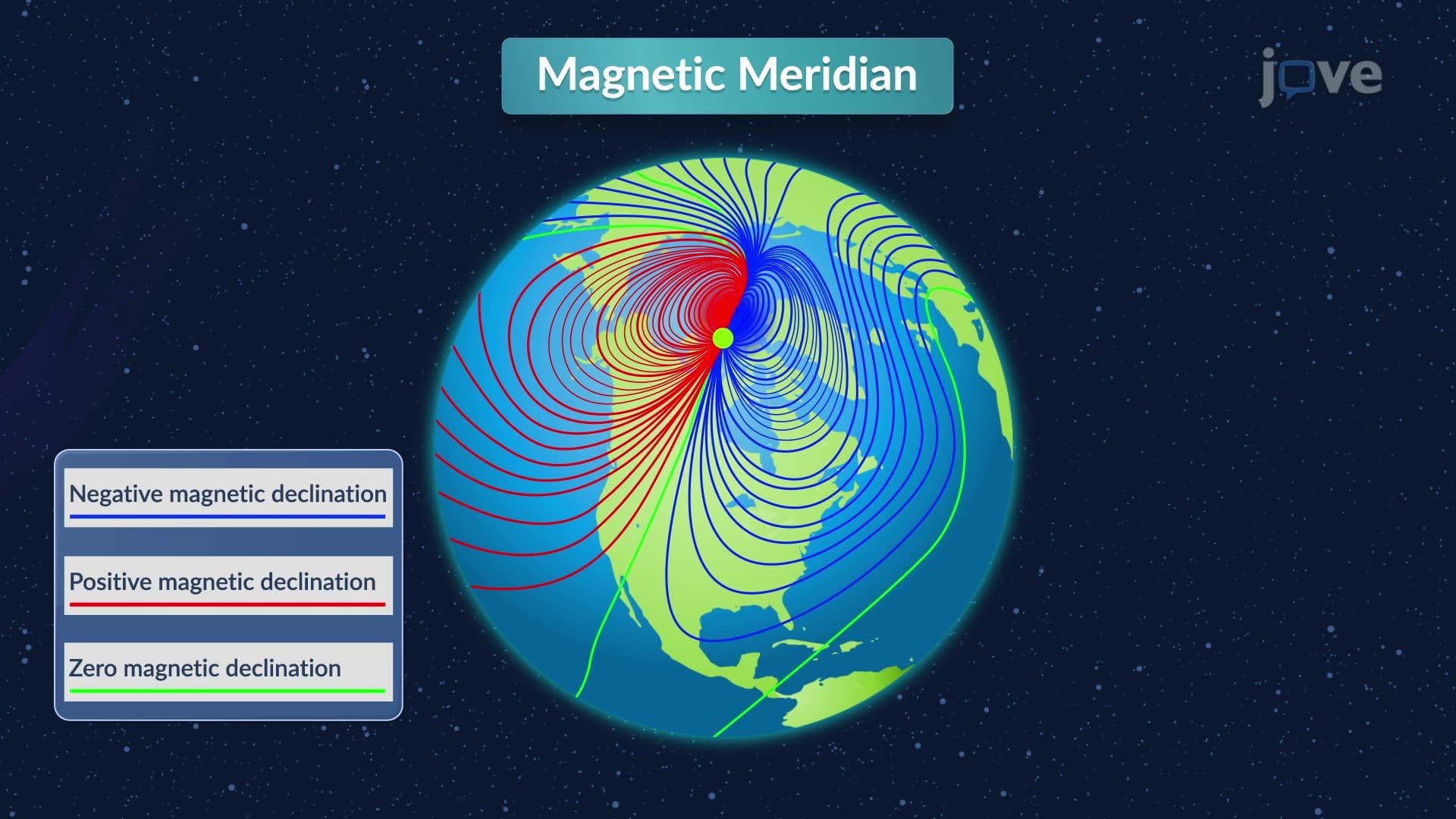
The meridians definition encompasses both geographic and surveying contexts. Geographic meridians are lines of longitude that run from the North Pole to the South Pole, with the Prime Meridian serving as the global reference point. In US surveying, however, meridians refer to the principal north-south lines established by the Public Land Survey System (PLSS), which divides much of the country into standardized townships and ranges. States like Nebraska, Kansas, and Iowa rely heavily on these meridian-based property boundaries for agricultural and development planning.
Understanding what is meridians in detail requires examining how these reference lines integrate with modern surveying technology. The State Plane Coordinate System divides each US state into zones, each with its own central meridian to minimize distortion in mapping large areas. For example, California uses six different zones, each with its own meridian, to maintain accuracy from the Pacific Coast to the Sierra Nevada mountains. This system proves essential for projects like the California Aqueduct, where precise elevation control must be maintained across hundreds of miles.
A comprehensive meridians study guide reveals how these concepts appear in standardized tests and professional practice. AP Environmental Science exams frequently test understanding of coordinate systems and mapping principles. College-level surveying courses require students to calculate distances and bearings using meridian-based coordinates. Professional licensing exams for civil engineers include questions about State Plane Coordinate Systems and their applications to real-world construction projects.
The integration of GPS technology with traditional meridian systems has revolutionized modern surveying. Projects like Boston's Big Dig tunnel system required precise coordination between GPS satellites and established meridian reference points to maintain accuracy during underground construction. This combination ensures that separate construction teams working on different sections can align their work perfectly when sections meet.
Related Micro-courses