Loading video…


 6 Concepts
 1.2K views

Video Summary: What Is Global Positioning System
Ever wondered why your Uber driver never gets lost, even in downtown Manhattan's maze of one-way streets? Errors in global positioning system technology can create navigation challenges that affect millions of daily users, from emergency responders to delivery drivers across America. The Global Positioning System relies on satellite triangulation, but atmospheric interference, signal blockage, and receiver limitations can cause location inaccuracies ranging from a few feet to several meters. Understanding What is Global Positioning System and its error sources helps explain why your phone sometimes shows you standing in the middle of a building when you're actually on the sidewalk. Watch the full video on JoVE Coach to master this concept with expert-led visuals and step-by-step explanations.
The Global Positioning System represents one of humanity's most remarkable technological achievements, yet like all complex systems, it faces inherent limitations that create positioning errors. These errors in global positioning system functionality stem from multiple sources, each contributing to the final uncertainty in your device's location calculation.
The most significant GPS errors originate from signal propagation delays as satellite transmissions travel through Earth's atmosphere. Ionospheric delays occur when GPS signals pass through charged particles in the upper atmosphere, slowing signal speed and creating distance measurement errors of up to 15 meters during peak solar activity. Tropospheric delays happen in the lower atmosphere due to water vapor and temperature variations, typically adding 1-3 meters of error.
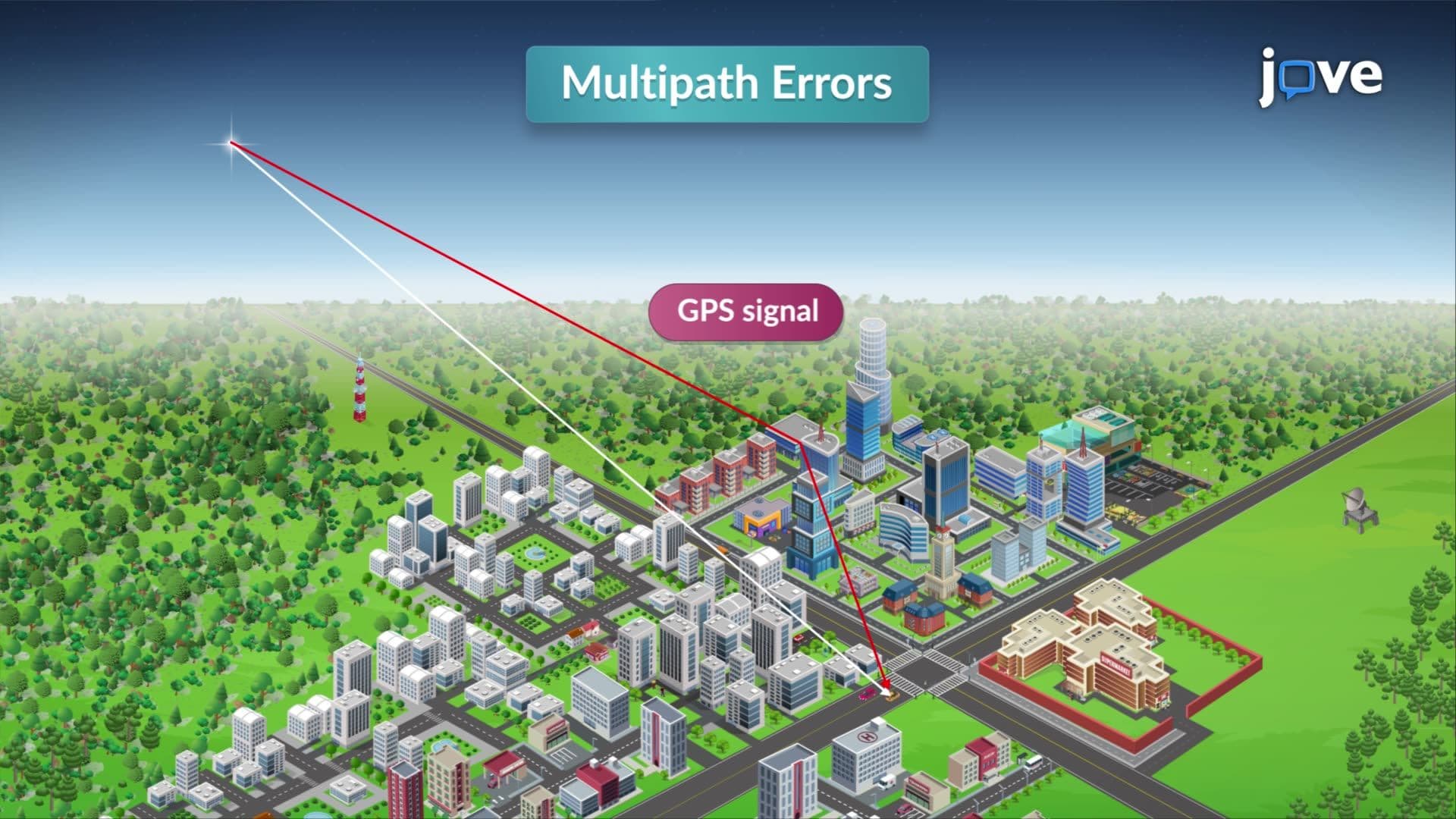
Multipath interference presents another major challenge, especially in urban environments like downtown Chicago or New York City. When GPS signals bounce off buildings, creating multiple signal paths to your receiver, the device struggles to determine which signal represents the direct path from the satellite. This phenomenon explains why navigation apps sometimes show erratic position jumps when walking between skyscrapers.
Satellite geometry significantly impacts positioning accuracy through a concept called Dilution of Precision (DOP). When available satellites cluster in one area of the sky rather than spreading evenly, position calculations become less reliable. This geometric challenge affects hikers in canyons, drivers in tunnels, and anyone using GPS in environments with limited sky visibility.
Receiver clock errors also contribute to positioning uncertainties. Since GPS relies on precisely timed signals to calculate distances, even nanosecond timing errors translate to meters of position error. Modern receivers address this through sophisticated algorithms, but the fundamental challenge remains.
Understanding these error sources proves crucial for AP Physics students studying wave propagation and signal processing. College engineering programs examine GPS errors when teaching satellite communications and navigation system design. The Federal Aviation Administration requires pilots to understand GPS limitations for instrument flight procedures, making this knowledge essential for aviation careers.
Emergency response systems across the United States must account for GPS errors when dispatching ambulances or coordinating disaster relief efforts. The margin of error can mean the difference between reaching victims quickly or arriving at the wrong location during critical situations.
Related Micro-courses